
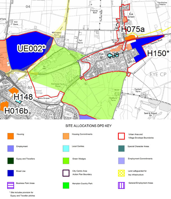
In 2010 Peterborough City Council released its Site Allocations Development Plan Document, which outlined how the city and its surrounding area could be developed up until 2021. The plans for Eye included plans to build 305 homes, 10 travellers’ pitches and a plot for travelling show people to be built in the village. Added to this will be the Norwood development (2,300 homes plus industry – (UE002 on consultation now SA1.5)) just outside the parish boundary but within easy walking distance of the village.
In April 2011, as part of the consultation into the plan, the council held a meeting in Manor Farm Community Centre in the village. Almost 300 turned up to object to the proposals. Dale McKean who was chairing the meeting handed over 563 letters of objection to the councils planning representatives. Mr McKean said: “It’s fabulous to have seen so many people here, it shows that democracy is working. “The villagers have had their say and let’s hope the city council are listening.”
In response to a question about the reason Eye was so important, Richard Kay, Council’s Policy and Strategy Manager, said: “The whole of the unitary area is essentially up for getting more development but the villages have got to take a bit of the contribution. “Out of 25,000 homes, the villages of Eye and Thorney are only taking 600 new homes but I do accept that it’s a large amount for Eye.”
Taking into account villagers responses the city council removed the housing (H150 on the map below) to the south side of Thorney Road and removed the need to implement travellers pitches in the submission version of the plan.
“We are a village, not a ‘Key Service Centre'”
In December 2011 the independent inspector from the Planning Inspectorate proposed five changes to the authority’s plan for future housing, workplaces, leisure and other facilities. Despite local opposition two of the changes included re-adding some of the development at Thorney Road for 50 homes and adding another at Crowland Road, Eye Green for 25 homes. That makes a total of 160 additional houses and an Industrial estate in Eye on top of those that have already been built over the previous five years.
The Evening Telegraph reported that MP for Peterborough Stewart Jackson described it as a “slap in the face for the residents and would consider approaching the Secretary of State for Communities and Local Government, Eric Pickles, about the apparent disregard for public opinion. ”
The evidence is there that growth is detrimental to the village. On Friday 9 September 2011 Eye had its first drugs raid in the village’s history on the new Bath Road housing estate. In an early morning raid, armed police arrested a suspected drugs dealer on the new estate. The story here and here.
“Eye is proud to be a village, we don’t want to become a township or a suburb of Peterborough”
For a full list of documents visit the Peterborough City Council site here. Core Strategy Preferred options is here. This plan is only until 2021, after that the process will start all over again. I suspect Eye will be under the same pressures all over again.
Notes
Marco Cereste, leader of Peterborough City Council is chairman of LarkPoint and Nottingham based Charterpoint Developments. Larkfleet homes which is part of the group is one of the companies who have been building a large quantity of the new housing in the village.
The Conservatives introduced the New Homes Bonus in April 2011. The scheme will match the additional council tax raised for new homes and empty properties brought back into use, with an additional amount for affordable homes, for the following six years. The idea is that the extra money raised is spent in the community where the growth is taking place.
There are two good points in all this – The plans include the old railway trackbed between Thorney and Eye being turned into a footpath/cycleway, at the current time there is no easy way to cycle to Thorney safely. Also, a green wedge to the south of Eye, between the village and Peterborough in the area that used to be part of the green belt is to be created. The growth also means more money for the Parish Council via the precept.
Appendices
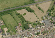
Appendix 1 – Maps and summary of developments
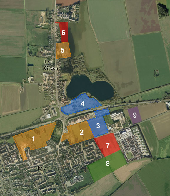
| Code | Description (As of 2011) | Size (Ha) | Dwellings | Code |
| 1 | Land to north of High Street Bath Road estate (completed) |
2.6 | 112 | SA5.1 |
| 2 | Odams Mill/land to north of Thorney Road The Spinney/Millport/Whitby Avenue (nearing completion) |
4.6 | 120 | SA 5.1 |
| 3 | Land to north of Thorney Road On the submission plan |
1.8 | SA 5.5 | |
| 4 | The old brickyards site. Land South of Nature Reserve, Eye Green |
2.4 | 35 | SA 5.4 |
| 5 | Baxters Warehouse Verde Close |
1.1 | 64 | SA 5.3 |
| 6 | Land off Crowland Road, Eye Green Added by the independent government inspector |
1.13 | 25 | H070a |
| 7 | Land to south of Thorney Road, Eye In the original proposal but taken out on the submission version. Re-added by the independent government inspector. |
2.62 | 50 | H150d |
| 8 | Land backing onto Eye School In the original proposal but taken out on the submission version. |
3.9 | 80 | |
| 9 | Land for industry | 1 | N/A | SA 14.2 |
| A | Norwood | 2300 | UE02 |
Appendix 2 – Media
Peterborough Evening Telegraph articles:
- Tuesday 26 March 2002 11,000 new homes to be built in city
- Monday 6 August 2007 64 new homes set for village
- Monday 29 October 2007 Special Report: ‘Exciting time’ for city as growth plan unveiled
- Friday 28 August 2009: New homes target could rise to 32,000 new homes
- Wednesday 18 November 2009 Regeneration: Education, housing and leisure developments
- Monday 12 April 2010 Meeting to discuss travellers site plans
- Wednesday 21 April 2010 Meeting: Hundreds object to Eye housing plans
- Friday 23 April 2010 Election 2010: Eye and Thorney expansion fight to go on after elections
- Friday 23 April 2010 Villagers protest
- Tuesday 4 May 2010 Review is the next step for homes and traveller plans
- Wednesday 28 July 2010 Hope in fight against travellers’ site plans
- Monday 13 September 2010 Eye and Thorney campaigners anger over plans for consultations
- Friday 15 October 2010 MP to speak out against Eye housing
- Tuesday 19 October 2010 Development plans: 20,000 homes and new business parks for Peterborough
- Friday 10 December 2010 Housing plans given go-ahead
- Friday 25 February 2011 Eye village development: Businesses back new homes plan
- Friday 2 December 2011 New homes proposed for Eye
- Friday 2 December 2011 Outcry at plans for homes in Eye
- Friday 7 December 2011 Eye can’t cope with more growth
- Tuesday 27 March 2012 Debate rages as Peterborough’s blueprint is approved
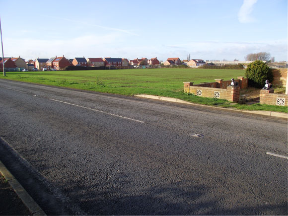
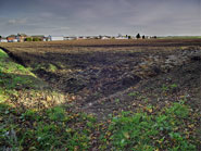
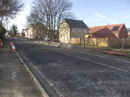
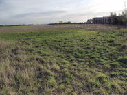
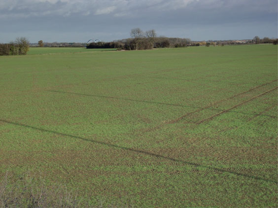
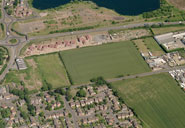
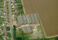
Appendix 3 – photos of affected areas
Appendix 4 – Key Service centres and the Regional Spatial Strategy
Policy SS4 of the Regional Spatial Strategy states that development in rural areas will be focused in market towns and thereafter in key service centres. Peterborough has no market towns but Eye is the largest village in the Peterborough Area. Key Service Centres are defined as large villages with a good level of services, including the following: – a primary school within the settlement and a secondary school within the settlement or easily accessible by public transport; primary health care facilities; a range of retail and service provision capable of meeting day-to-day needs, in particular for convenience shopping; local employment opportunities; and frequent public transport to higher order settlement.
Regional Spatial Strategies were introduced in 2004 but in May 2010 the new Government announced the abolition of the Regional Strategies. They were formally revoked, under s79(6) of the Local Democracy Economic Development and Construction Act 2009, on 6 July 2010
Supporting guidance to local authorities upon the revocation of RSS stated: “In the longer term the legal basis for Regional Strategies will be abolished through the “Localism Bill” that we are introducing in the current Parliamentary session. New ways for local authorities to address strategic planning and infrastructure issues based on cooperation will be introduced.